



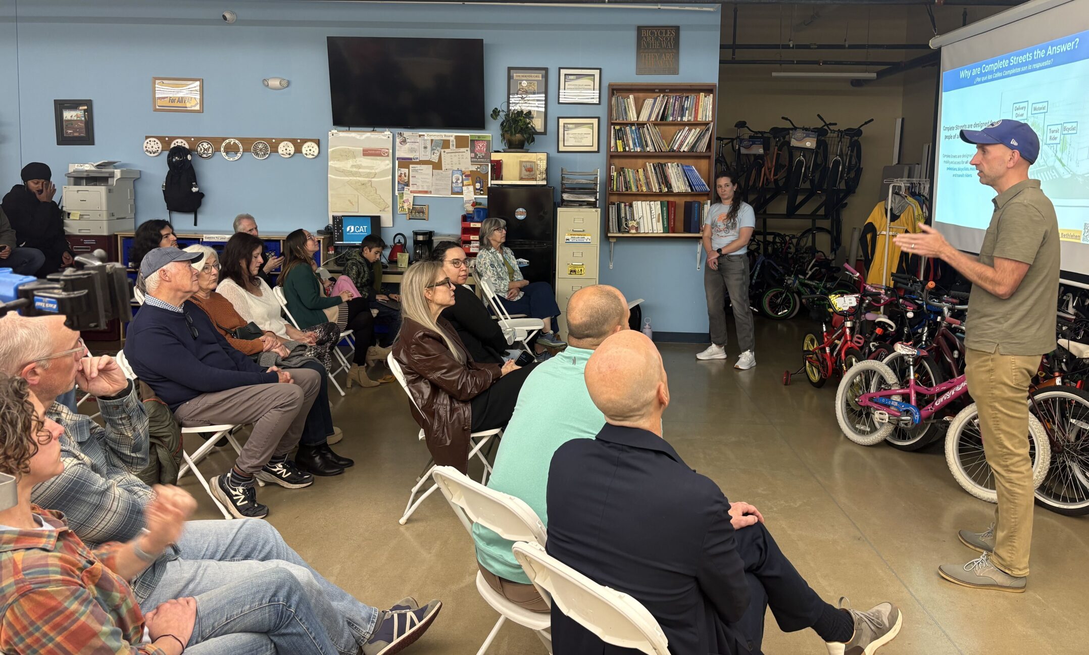
On an average day in Bethlehem, a pedestrian waiting for traffic to clear, a cyclist sharing the road with passing cars or a person using a wheelchair navigating a dead-end sidewalk experience the same street in completely different ways.
For roads with long crossing distances, speeding traffic and few safe places to cross, getting from one side to the other can be a challenge in itself.
Bethlehem’s Complete Streets Plan aims to change transportation culture by rethinking how the city’s streets serve the people who use them.
Mayor J. William Reynolds and Cathy Fletcher, the city’s director of planning and zoning, unveiled the plan Thursday evening at the Coalition for Appropriate Transportation (CAT) headquarters at 33 W. Walnut St.
The coalition is a local non-profit, which advocates for safer walking and bicycling infrastructure across the Lehigh Valley.
In order to determine a plan that uses crash data, street conditions and community feedback to identify high-priority corridors and guide future improvements. These improvements include safer crossings, better connections for cyclists and more accessible routes to public transportation.
Reynolds and Fletcher also outlined projects expected to move forward in 2027 as Bethlehem works to address safety concerns across its street network.
Rethinking road development
Reynolds compared the experience of walking along Main Street, with frequent crosswalks and access to public transit, to Stefko Boulevard in Bethlehem, where wide roads and longer crossings can make pedestrians feel less comfortable.
Main Street has one travel lane in each direction, and its design encourages people to spend time downtown rather than simply drive through, he said.
Stefko Boulevard, by contrast, serves drivers traveling between destinations. Reynolds said the city must consider how that design affects people who live along the road and need to cross it.
“Streets aren’t just for cars,” Reynolds said. “They are for cars, but they’re also for pedestrians, for bikers (and) for people with disabilities.”
He said convenience for drivers shouldn’t be the only consideration when the city decides how to design its roads.
The plan proposes a range of potential improvements, including curb extensions to shorten crossing distances, more visible crosswalks, bicycle lanes and better connections between routes. Officials are also considering sidewalk accessibility and access to public transportation.
Reynolds said the city’s development options will depend on street width, surrounding buildings and other physical constraints. The goal is to identify which changes are feasible and make streets safer within those limitations.
Identifying dangerous streets
Reynolds also said the city developed a high-injury network to identify streets where crashes resulting in serious or fatal injuries occur more frequently. Planners combined crash information with other considerations, including bicycle connections, access to schools and major destinations, to prioritize potential improvements.
The plan identifies priority corridors across the city, including Broad Street East and West, Center Street, Linden Street, Stefko Boulevard and the South Side Safety Project.
Stefko Boulevard is among the corridors receiving immediate attention.
Reynolds also said several South Side streets appear on the high-injury network. Since many of those roads connect to one another, the city is examining the South Side as a broader transportation network, rather than treating each street as an isolated problem.
Some curb extensions have already been installed: examples can be found near Third and Fourth Streets, Reynolds said.
However, the streets may not have enough space for the same improvements planned for Broad Street. The city is considering preliminary engineering work to determine what changes could be made across connected streets.
The city is also continuing work on its Broad Street corridor project, which Reynolds described as an example of how road redesign can create more space for pedestrians and cyclists. Proposed treatments for Broad Street include curb extensions, bicycle infrastructure, renovated crosswalks, and improved access to bus stops.
Other work includes low-cost complete streets treatments, such as restriping and pavement marking upgrades built into programmed PennDOT resurfacing projects along Linden Street and New Street.
The city also plans to push forward on the Monocacy Way Trail, an urban pathway running along Monocacy Creek that connects northern neighborhoods to the historic downtown, alongside the further development of the city’s broader bicycle network.
The plan is intended to guide decisions over several years. While some projects already have funding, others will depend on additional engineering, grants and city resources.
A connected bicycle network
The city is seeking to address a problem that individual bike lanes can’t solve on their own: gaps between routes.
Scott Slingerland, the director of the Coalition for Appropriate Transportation, participated in the plan’s steering committee. He said the process combined data with feedback from people familiar with Bethlehem’s streets.
Slingerland said the challenge is connecting comfortable stretches of roadway with routes that people currently find difficult to navigate.
City officials acknowledged some routes may require additional discussion and adjustments after initial improvements are made. They also said they are working with community partners on bicycle rides and other efforts to understand how the network functions in practice.
Imagining a different way to get around
City Councilwoman Hillary Kwiatek, who served on the steering committee, said she hopes the plan will make cycling a realistic option for Bethlehem residents.
Kwiatek, who lives on the West Side, said she hopes for a future in which she could ride her bicycle across town to shop at the Bethlehem Food Co-op and return home, while passing families walking and biking along Broad Street.
She also said she believes the physical design of streets can help influence how drivers behave and how comfortable residents feel in their neighborhoods.
“By the time we hit our target year of 2035, I hope we really are transformed,” Kwiatek said.
The plan’s implementation will depend on funding, engineering decisions and continued support from city officials and community partners. Reynolds said the city intends to keep refining its priorities as projects progress and new funding becomes available.
For residents, the eventual test will be whether those plans make it easier to cross busy roads, travel between neighborhoods and reach everyday destinations without feeling unsafe.
The city has published the full interactive data, maps, and high-injury network findings of the Complete Streets Plan on its We Build Bethlehem website.
Comment Policy
Comments posted to The Brown and White website are reviewed by a moderator before being approved. Incendiary speech or harassing language, including comments targeted at individuals, may be deemed unacceptable and not published. Spam and other soliciting will also be declined.
The Brown and White also reserves the right to refuse the publication of entirely anonymous comments.